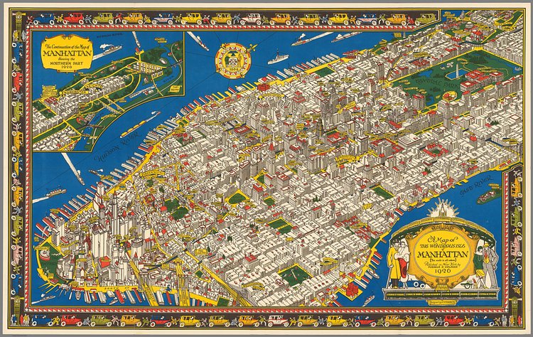
"The Wondrous Isle of Manhattan" is an incredible vintage map showing an illustrated interpretation of the borough as it appeared nearly 100 years ago. Landmarks, parks, major streets and buildings are all clearly labeled, and you can even spot the old elevated trains on the avenues.
The map was designed and illustrated by Charles Vernon (C.V.) Farrow in 1926.
Farrow's map of Manhattan is full of interesting details well rendered, all of which contribute to an outstanding design and makes this map one of the best pictorial maps of the 1920's in the United States. This appears to be the only major city map that Farrow designed, although he did design a world map for Simon and Schuster in 1927 showing their publishing activities worldwide. He died young, at age 40.
Check out the specimen page for more info on the map or for a larger downloads.

Matt Coneybeare
Editor in Chief
Matt enjoys exploring the City's with his partner and son. He is an avid marathon runner, and spends most of his time eating, running, and working on cool stuff.
Something wrong with this post? Let us know!

