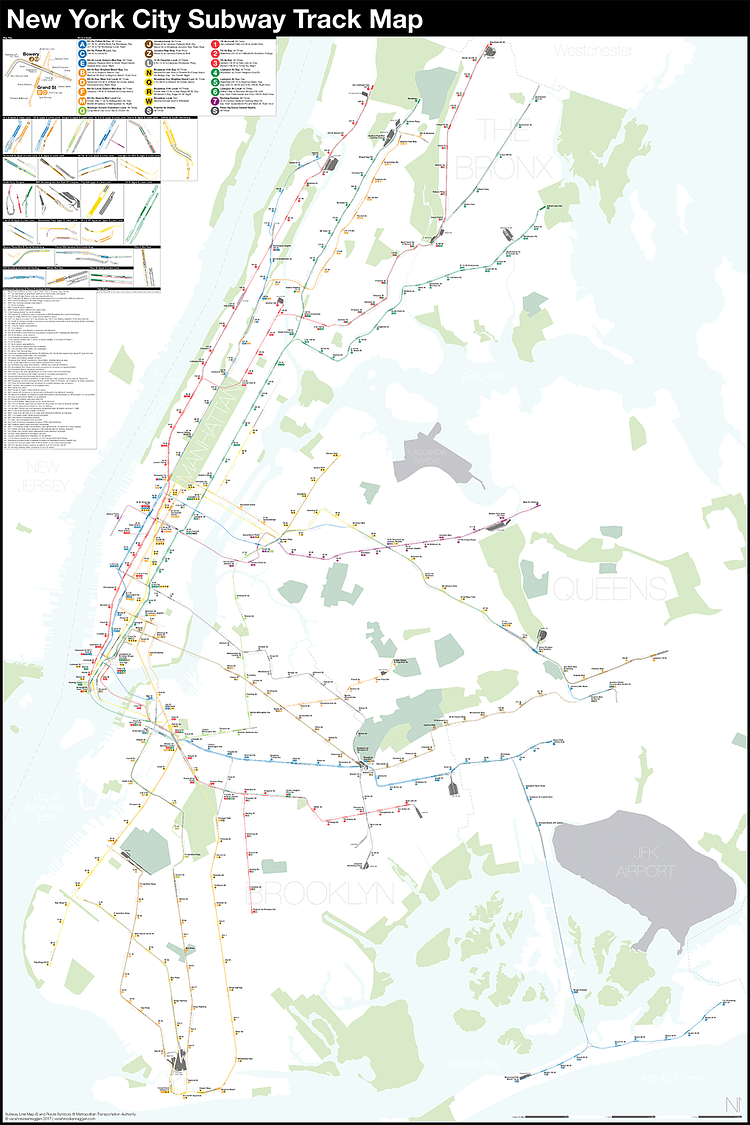
Local photographer and cartographer Andrew Lynch runs an interesting blog called Vanshnookenraggen (previously) in which he combines his love for the City, transportation, and maps to write great data-based articles on the City's subway system. For a recent article, Lynch created this highly detailed, fully complete, and geographically accurate map of New York City subway tracks.
To show a system map as it truly exists you need to find a track map. A track map is exactly what it sounds like, a map showing the individual tracks, crossovers, and station platforms as they really exist. Track maps are often drawn as simple schematics with straight lines for rails and boxes for station platforms. Most people would never have to use one and in fact their primary use is in control towers to display where trains are and which switches are thrown (therefore showing the route of a train). Because the control tower only needs to know where trains are and where they are going the track maps are even simpler than subway route maps.
Check out the full article for more details on the data source and methods used to create the map.

Matt Coneybeare
Editor in Chief
Matt enjoys exploring the City's with his partner and son. He is an avid marathon runner, and spends most of his time eating, running, and working on cool stuff.
Something wrong with this post? Let us know!


