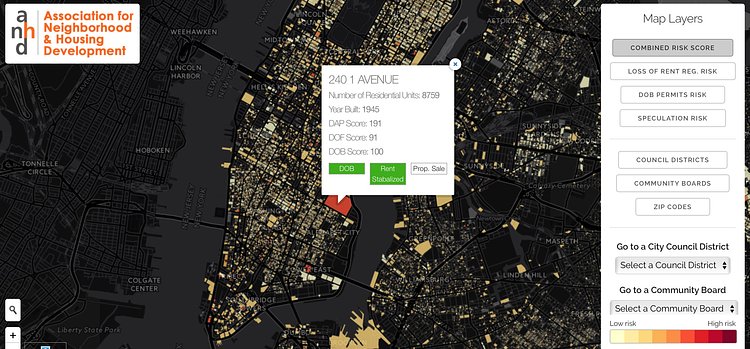
The Displacement Alert Project Map from ANHD is an interactive map of New York City neighborhoods and blocks that shows which areas are at the highest risk for gentrification and other changes that cause displacement.
Dap.Map is a building-by-building, web-based interactive map for NYC designed to show where residential tenants may be facing significant displacement pressures and where affordable apartments are most threatened. ANHD created Dap.Map to provide community groups, local residents, elected officials, policymakers, and the public direct and real time access to vital information on our city’s rapidly changing residential environment.
Check out the full map to see how your neighborhood has been changing.

Matt Coneybeare
Editor in Chief
Matt enjoys exploring the City's with his partner and son. He is an avid marathon runner, and spends most of his time eating, running, and working on cool stuff.
Something wrong with this post? Let us know!


