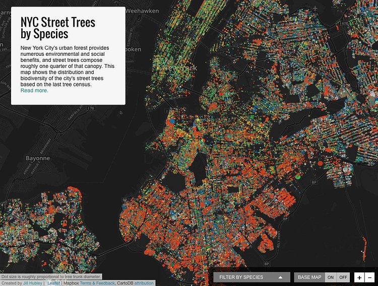
Brooklyn based software engineer and data visualizer Jill Hubley recently created an interesting project called NYC Trees that plots all of the City's species of trees block by block in a colorful, interactive map.
New York City's urban forest provides numerous environmental and social benefits, and street trees compose roughly 25% of that canopy.1 While I had seen some numbers on the percentage breakdown of species throughout the city, I was interested in looking at the composition in detail. I wanted to see what patterns took shape in various neighborhoods, and across the city, and to see how the density of trees shifted.
To create the map Hubley aggregated data from the last NYC tree census, available on NYC's open data portal. For more about her process of turning the raw data into a beautiful interactive visualization tool, check out the map's accompanying article on Hubley's website.

Matt Coneybeare
Editor in Chief
Matt enjoys exploring the City's with his partner and son. He is an avid marathon runner, and spends most of his time eating, running, and working on cool stuff.
Something wrong with this post? Let us know!


