Local software developer and data visualization enthusiast Thatcher Clay recently compiled these great maps for his site urban_calc that show how old buildings in Brooklyn are.
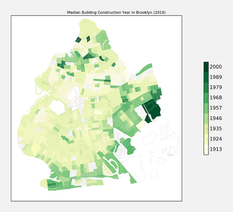
The oldest neighborhoods are Ocean Hill (1911) and a four way tie between North Side-South Side, Cypress Hill, Park Slope, and Styvesant Heights - all with a median building year of 1920. The newest neighborhood is Coney Island (1969), followed by West Brighton (1962), East New York (1961), Canarsie (1960), and Williamsburg (1956).
The green map above shows the age of the median home in each sector, but that doesn't always tell the whole story.
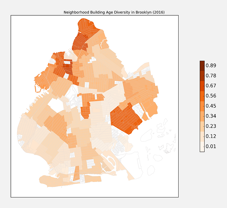
When walking around a neighborhood like Park Slope you tend to notice not just that the building are old, but they are all old - there is a general consistency in the building age. Below is a map that attempts to capture that - measuring the diversity of building ages within Brooklyn neighborhoods (high diversity is darker, more consistency in age is lighter):
The areas which are darker mean that the neighborhood was built up over decades, like Williamsburg and Greenpoint, where other areas like Bay Ridge and Dyker Heights all developed their buildings at about the same time.
Check out the accompanying articles for insights and methodology on the data collection.
via urban_calc

Matt Coneybeare
Editor in Chief
Matt enjoys exploring the City's with his partner and son. He is an avid marathon runner, and spends most of his time eating, running, and working on cool stuff.
Something wrong with this post? Let us know!


