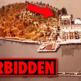
Photo:
NYC Records
This vintage aerial photograph from the early 1930s shows the Sheepshead Bay neighborhood in Brooklyn before the addition of Robert Moses' Belt Parkway cut-off the neighborhood's access to and views of the bay. Here is a present-day view from approximately the same angle:

via r/Brooklyn

Matt Coneybeare
Editor in Chief
Matt enjoys exploring the City's with his partner and son. He is an avid marathon runner, and spends most of his time eating, running, and working on cool stuff.
Something wrong with this post? Let us know!
![Rockefeller Center under construction, New York City, 1932 | Rockefeller Center rises in mid-Manhattan. Photograph by Hamilton M. Wright for Aerial Explorations, Inc., N.Y., 1932.
From the New York World-Telegram Collection at the <a href="http://memory.loc.gov/ammem/index.html" rel="nofollow">U.S. Library of Congress</a>.
<a href="http://flickr.com/search/?q=world-telegram&m=tags&w=76204898@N00&s=int">More pictures from the World-Telegram Collection</a>
<b>[PD]</b> <a href="http://hdl.loc.gov/loc.pnp/cph.3c36071" rel="nofollow">This picture</a> is assumed to be in the public domain.](https://cdn.viewing.nyc/assets/media/c03f905321f5e3e383d381201f21932e/elements/11d6625c54957665b67a1a7dae87b3ad/xs/2d9e6f2e-13c0-4bcf-8139-2834c4286132_2x.jpg)